Statistics about the Paxton Creek Watershed.
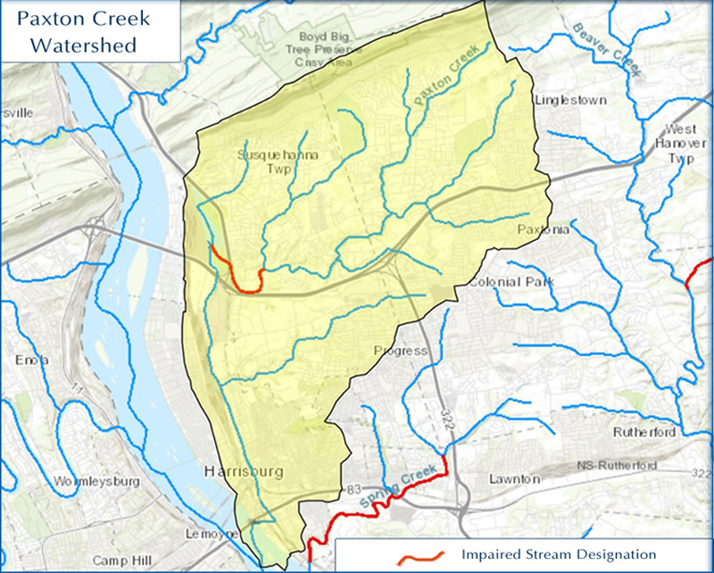
Watershed Characteristics:
Drains 27 square miles
Land Use:
- 53% Developed
- 25% Agricultural
- 22% Forested
Consists of over 50 stream miles
Chapter 93 stream designation – Warm Water Fishes
With over 16 miles listed as impacted by pollution
Contains some of the highest pollutant yields in the Susquehanna Basin
Has combined sewer overflow problems
Experiences flooding problems
This map is a product of the US EPA WATERS GeoViewer, utilizing ESRI GIS software.